East Fork Chulitna-Mistakes Made & Lessons Learned

18 06 2015

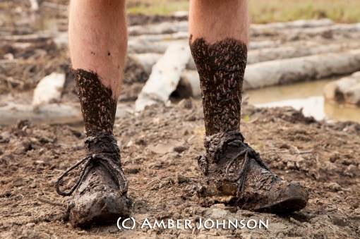
I’m not sure why, but every time we start these trips, we try and avoid getting our feet wet at all costs, knowing full well it’s just a matter of time (and usually sooner than later) that our feet will be soaked. In the first 1/4 mile we ran into a large puddle/pond in the four wheel trail and bushwhacked around it. This was the first (and really only) bushwhack of the first day….Less than 20 minutes later our feet were soaked for the duration of the trip.

After going through bushwhack hell on the last trip using the Hardage Creek Route, we decided to take the northern route this time-we’ve seen great reports of little bushwhacking and decided to give it a try.

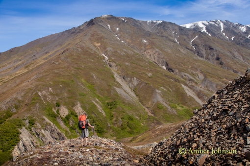
Beautiful views of Denali and the Alaska Range. Another amazing, sunny, warm weekend in Alaska.denali view beginning

After we left the easiness of the four-wheeler trails, we found some great high alpine game trails.

Boone hiking up towards the pass.

boone hiking

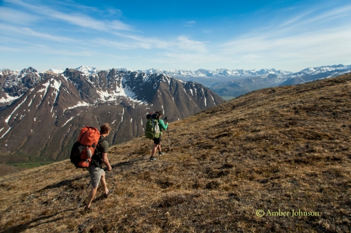
Jeff & Sarah climbing towards the pass.

sarah & jeff hiking

After reaching the pass, we looked at the map. Previous packrafters had taken the ridge left (headed slightly farther upriver), descended towards the creek, then made another pass before getting to the East Fork Chulitna near Crooked Creek. The East Fork Chulitna seemed so close! We decided to roll the dice & try our own route, knowing quite well the odds were greatly against us. Crazy thing is we succeeded 🙂 By doing this, we probably cut 3 miles off the hiking portion of the trip and only sacrificed about 1/2 mile of floating. We decided to stay high, traversing the ridge right.

Boone & Kasey.

 kasey and boone hiking

We started descending the nose & found a good place to take a break and fuel up before what we thought potentially could be a long bushwhack to the river. Here’s the view looking up river to Crooked Creek area. Once we descended to the valley floor, we wound up hiking in the general direction of up river, ending about 1/2 mile below the confluence of Crooked Creek.

checking maps

View down river & faintly the Alaska Range.

 group view of valley

We managed to find a route down, all tundra hiking. From the top we scouted several treeless areas & headed towards the first one. We easily linked up open areas with animal trails through the trees. It was definitely not a bushwhack. We even found a large downed tree to cross the creek on.

Sarah heading down the nose.

   sarah hiking down

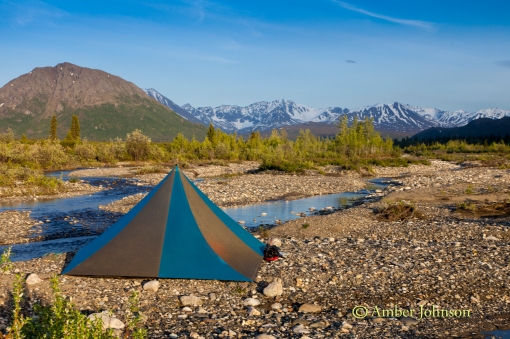
Camp! I love Alaskan summers! I took this at 10:30 pm.

camp

Our put-in to the East Fork Chulitna.

yak

The first few miles of the paddle went smoothly. Fun, Class 2. Splashy. I’ve done this paddle before and loved it. The two canyons were challenging and the rest was pure easy fun. I led the paddle into the first canyon-a Class 3/3+ canyon. After making the first few rapids, I made a costly mistake-I got to close to a boulder, got high sided, from which I couldn’t recover and went for the swim of my life. I’m not sure if it was complacency  or just the littlest/giant mistake. Going into that rapid, I thought I had it. There wasn’t even a question in my mind. Now, instantly, I knew I was in pretty big trouble. There are few small eddies in the canyon, mostly rock walls, and I had 3 big drops to go & probably 125 yards till the river calmed back down to a fast Class 2.

I managed to hang on to my raft and my paddle, trying desperately to right my raft & when eddies appeared swimming desperately for them. I was almost able to catch one or two before the current grabbed me & threw me into another rapid. I was being thrown into boulders & over drops, getting pushed underwater, then being able to come up for air in time for the next one. My crew was desperately trying to catch me & help, doing everything possible. At one point, Kasey got to me, but I was unable to get close enough to her to grab her boat before we got separated in a rapid. Finally, my boat got caught on a large boulder (upside down) in an impossible place in the river. Boone caught up with me at some point & I was able to grab onto him for a second before we came upon the next rapid and had to let go. I was absolutely exhausted and knew I had to keep fighting. I kept swimming with my paddle, the river tossing me around like Raggedy Ann, with my head headed straight into a boulder. I narrowly missed bashing in my skull (how I don’t know, I was suprised-Boone saw it and was trying to figure out how he was going to get me unconscious or dead out of the river.) Regretfully, I had left my helmet at home. Definitely, won’t be doing that on future trips. Finally, I dumped out of the canyon into Class 2. The river isn’t terribly deep here-knee to mid thigh-just super fast. Boone managed to get to me, with Jeff right behind him. I grabbed onto the rope on the rear of his boat and he managed (I don’t know how) to get us to shore-NOT in an eddy (He said it was like dragging 3 boats). He jumped out of his boat, grabbed me with one hand & his boat with the other hand. I was so exhausted I couldn’t walk. I laid on shore breathing hard & exhausted-happy to be alive.

My hands were frozen-screaming barfie style, but the rest of me was relatively warm & dry. I felt like I had been through Fight Club-exhausted, my legs were so beat up-deeply bruised muscles, with visible ones on the surface (some bigger than my hand), as well as some good gashes. But I was ok. I did get a hole in my brand new Stowaway Tough drysuit by Alpacka-although, I truly believe this would have happened in my regular Kokatat drysuit as well. My long underwear was also ripped and I had a gash in my knee where the drysuit was ripped. I stayed pretty dry despite the hole. In the end, my pack broke the Packtach rope in half from the water pressure & floated downstream. Boone was able to jump in his boat & grab it. The pack coming off knocked the boat off the boulder into an eddy. Kasey & Sarah had managed to eddy out and grab it. Also, it happened to be one of the fewer parts of the canyon they could hike out of-so they packed up everything & hiked out to us.  I was so happy to see them.

Since I was to exhausted to boat the second canyon, (and the big class 3/4) rap, we had to hike around it (maybe 1 or 1 1/2 miles). I mean bushwhack. It was the hardest hike ever due to my legs being completely sore & beat up. My muscles barely wanted to put one foot in front of the other, much less with a pack & climbing over hills.  Thankfully, my crew grabbed my boat, paddle & pfd to take some weight off my back. Sometime after the big rapid, we managed to hike down to the river & paddle the rest of the trip. The rest of the float is a fun, splashy Class 2 all the way back to the highway. Although, I tried to enjoy the rest of the paddle, and definitely had some good moments, it just wasn’t the same for me. We got back to the car a few hours later than we expected due to the swim, and ended up getting “stuck” in Talkeetna, due to the Sockeye fire in Willow. It was 80F and a good place to chill out, relax, & reflect over a few beers on the banks of the Talkeetna River with the sun setting over Denali.
sunset denali talkeetna


Chickaloon River (the hard way) via Puddingstone Mountain

29 05 2014

 I’ll be the first to NOT recommend the hiking portion. At least the backside of Puddingstone Mtn. I’m not sure it even qualifies as Type 2 fun. On the other hand, the Chickaloon River is a super fun, splashy float! With below average water flow it was Class 2 most of the way, with Class 3 sections above & below Hotel Rocks and the one final drop before the highway.

Our original planned packrafting Memorial Day/Kasey’s 30th birthday trip got derailed by low water. So Friday night, the six of us were sitting around at Ryan’s family’s house in Chickaloon studying maps and looking for a new trip. Ryan’s dad suggested that if we were “badasses” we could start hiking up the atv trails at Purinton, then wrap around the backside of Puddingstone Mountain (the pass is approximately 4000 ft) and then drop down to the Chickaloon River to float out. Seemed easy enough. Admittedly, I didn’t study the map that well. In fact, since I have the WORST sense of direction, and easily get lost (even with a map, even in places I’ve been before-for some reason rocks, trees, and mountains all look the same to me 🙂 ), I usually rely upon friends to help me navigate the backcountry. That being said the map indicated a “historic trail” which we were hoping to use. Actually, we did use it and it was great. Until we couldn’t anymore……….

We even were thinking that although we had originally planned for a 3 day trip, this is easily a 2 day trip…….Glad I left most of the extra food in my pack 🙂

Dan found mud on the ATV trails at Purinton 🙂

Dan Mud

 It was super smoky from the Funny River fire burning on the Kenai. Dan’s hiking in front of Anthracite ridge, which is barely visible with all the smoke.

dan hike smoke

Dinner at Boulder Creek. We took a pretty relaxed approach on Saturday, late start, early camp. We camped near here since it looked like the best place before the pass. Little did we know what Sunday Funday had in store for us……

dinner at Boulder creek

Smoky sun.

smokey sun tents

Kasey & Dan on the approach to the pass behind Puddingstone Mtn. We found easy atv trails that turned into game trails on the other side of Boulder Creek, then high tundra made for a pretty nice hike on this side of the pass. I didn’t look closely at the map and figured the other side was the same…..not so much.

dan kasey hike

Kasey and Sarah with the creek valley down below.

kasey sara hike

Once we reached the pass, the other side was snowfields galore! And it was all rotten, deep snow. We tried to sled (worked for a few feet), postholed up to our hips, and tried to roll across the snow. We looked completely ridiculous. Unfortunately, I didn’t take a good picture of the backside of the pass. It ends up dropping off significantly, with two choices to head down. One, being a snow gulley (We were reluctant with freezing feet & given the snow conditions we had just been through. Plus there was a cornice to negotiate). The second was a steeper angle down the front with loose rock over hardpack rock & dirt-which meant one-at-a-time could head down safely. Kasey, Dan & I found a way onto the snow gulley and headed down that way, while Dylan, Sarah, & Jeff took the nose down. We beat them by a long shot-the snow in the gulley was just hard enough, and had enough debris, to support our weight. We enjoyed a pretty easy descent. So far trip = good. Still thinking we could float today. Or, at the very least make it to the river early, set up camp, & enjoy some whiskey to celebrate Kasey’s 30th birthday.

Then came the rest of the trip to the Chickaloon. We started down the valley in the creek, crossing every ten feet it seemed. Not difficult hiking, but we weren’t making tons of progress either. The “historic trail” on the map indicated we climb 2000 ft up to the mountain on the right (across from Dan, Kasey, and Dylan in the picture below.) We realized historically they were mining, but I still have no idea how they crossed some of the ravines. Also, we found many 90-99 ft “cliffs” not indicated on the map (the elevation lines being every 100 ft.) The creek started descending and getting larger from tributaries, so we made the choice to bushwhack/climb straight up through alders to a clearing and reassess the situation. We came to some realizations. We couldn’t continue down the creek bed. Over the next mile would lose 1600 ft in elevation (waterfall) and the sides of the creek were getting cliff like. We could either try and gain the ridge on Puddingstone (another 1600-1800 ft elevation gain) and hopefully get down it (the map indicated it was super steep and this seemed really questionable) or return the way we came back over the pass which seemed like a horrible idea. We could see the Chickaloon about 2 miles away ish and really wanted to float! Not to mention, going back through the pass seemed a daunting task. We kept hiking to the ridge and the only spot we could see to camp for several miles in either direction-a little saddle on the ridge. I didn’t like this idea since it was so exposed, but there weren’t any other choices at this point. Here we are stopped for a quick dinner to fuel up for the rest of the hike up to the ridge.

cooking dinner

Gorgeous views on top of the ridge. Dylan, Dan, and Kasey looking at our options. The nose of the ridge dropped off quickly into cliffs. We explored a lot of options for an hour and a half off the end of the ridge and couldn’t find a way down. The other side of the ridge made a more gentle drop to the next valley, except the last 80 ft or so dropped off sharply too. We went to bed that night not sure if we could pick our way down into the next valley or had to do a death march back the way we came. I was super exhausted that night and morale was a little low even toying with the idea of hiking back over the pass. Plus, we were wondering if we’d be able to do it in one day with our heavy packs. I had barely just enough food for a full third day, and I kept thinking of the “extra food” I left in the car since it was just supposed to be an overnight trip……

checking options

The next morning we woke early, and were able to descend down to the next valley. To do this we had to descend up into the valley (going the opposite direction from the river). We were sooo excited! We’d get to the Chickaloon after all! We picked our way down the creek slowly, again crossing every ten feet over slippery rock, until again we had to gain the next ridge because this creek too dropped significantly. Looking back on the ridge we camped, there were one or two ways down it, but it mostly cliffed out. So glad we lucked out and found an easier way down. We climbed a snow gulley and gained the next ridge. A little more vertical climbing than I thought we would be doing on this trip 🙂 We knew the next ridge had a plateau, then had a more gentle slope down. We then found a nice game trail and hiked easily on it until we ran into this little guy. No mama in sight and he was crying & barely walking. He appeared to be about the same size as a german shepherd, less than a week old and pretty frail. Unfortunately, there wasn’t anything we could do for him and most likely his mama was dead. I’ve never seen a moose baby this young without mom being within 10 feet at most. Also, we were worried about bears in case she was dead in the area. It was sad.

baby moose 2

We left the game trail and started the easiest bushwhack I’ve ever done down to the river. Yay! The Chickaloon! We had a fun float out-such a great river!A few of us went for a refreshing swim in it:)  An adventure for sure, and a lesson or two learned 🙂

the Chickaloon!


Nordic Blading @ the Anchorage Coastal Wildlife Refuge (and a little bit of skiing)

28 11 2012

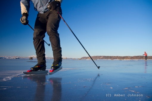
I’ve been scoping them out for a couple years now, and finally made the plunge the day before Thanksgiving. I bought nordic blades. They open up a whole new world in skating, making the uneven surfaces and obstacles embedded into the surfaces of  lakes, marshes, and tarns easy to skate on. As Jeff put it-they are like the 4×4 of ice skating.  Also, I’m trying to make lemonade out of a lemon of a winter so far…..the lack of snow (zero) has definitely impacted my enthusiasm, so I’m embracing what we do have plenty of-ice! 


I never would have guessed to head to the Anchorage Coastal Wildlife Refuge to skate on the inlet had I not found a note about it on a local ice skating forum. We had extremely high tides combined with cold temps this week that made the inlet/refuge into a nordic blade haven. 

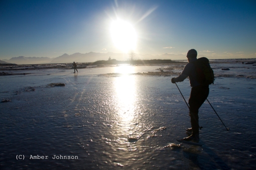
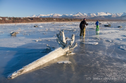
Eva and Dan heading into the noon sun….which isn’t far off the horizon this time of year.

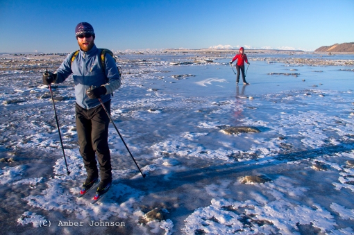
Some challenging ice….Nordic blades make this stuff completely doable.

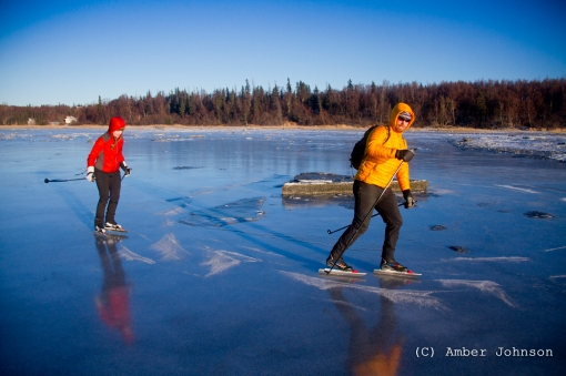
We found some beautiful ice! There were a lot of places where the ice was as nice as if it had been zambonied.

Jeff and Sabrina headed out with me a couple days later to try nordic blading. 

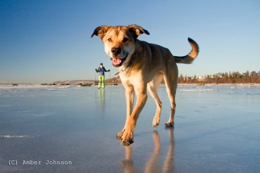
Tika seemed to get around just fine without skates.

I did manage to make it to Turnagain and ski over the weekend with Brian and Sabrina….to ski on snow that fell weeks ago. One of the only places that hasn’t been ripping out due to the cold, clear weather creating hoarfrost and instability was Tincan. We were suprised that it wasn’t as tracked out as we imagined it would be.

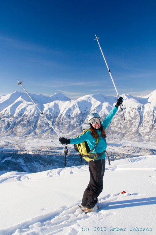
Sabrina enjoying the sunshine and temperature inversion on top of Tincan.

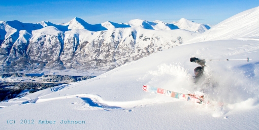
Just because Brian is one of the best snowboarders I know, I had to post this pic….it was fun watching him on skis for the first time since 7th grade 🙂

In all fairness, he did really well, and only fell this once.