Beaver Creek – Summit (no) Trail

19 06 2018

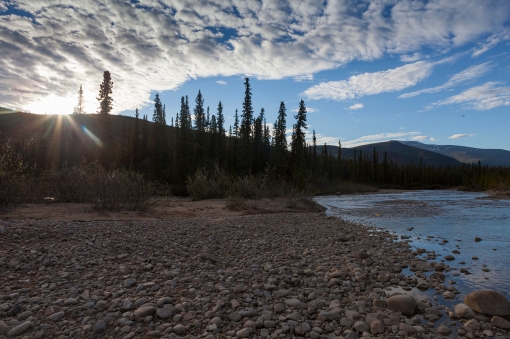
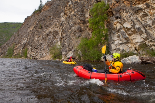
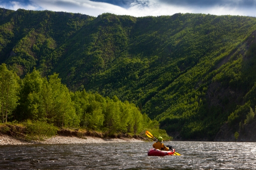
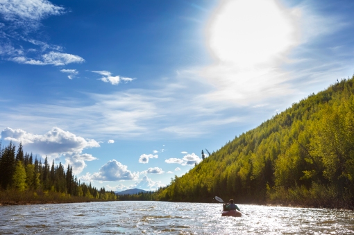
Kasey and I decided to take advantage of an early (hot) June weekend and explore her new stomping grounds in Fairbanks. Beaver Creek is a National Wild & Scenic River just north of Fairbanks in the White Mountains with road access. We slept in and got a little bit of a late start-we put in for the 35 mile float starting at Nome Creek at 1 pm._J6A8588
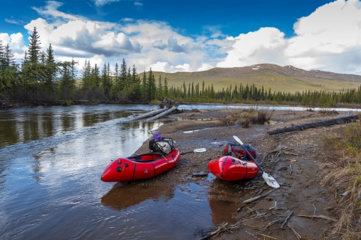
Beaver Creek is a Class 1 river that meanders through low, rolling mountains. It’s beautiful in every direction. _J6A8631_J6A8635
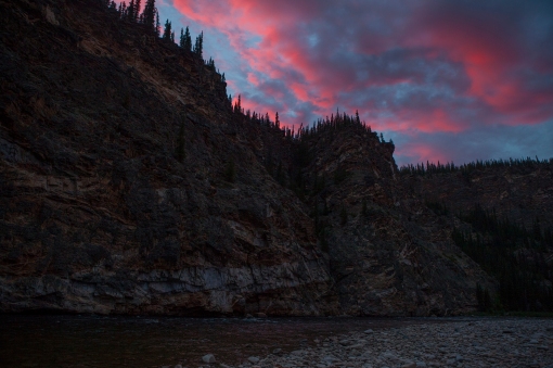
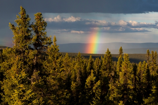
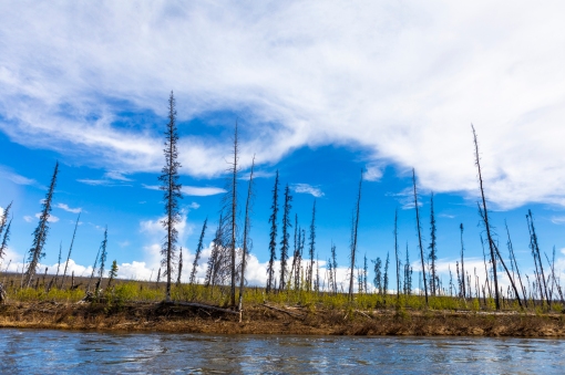
Lots of dead wood from previous forest fires. I love the interior weather-we had mostly hot & sunny, with thunderstorms rolling through at jet speed (which was a welcome temperature difference) and rolling out just as fast. We never got more than a couple drops of rain, however, surrounding us it looked like some areas were getting downpours._J6A8660_J6A8674_J6A8679
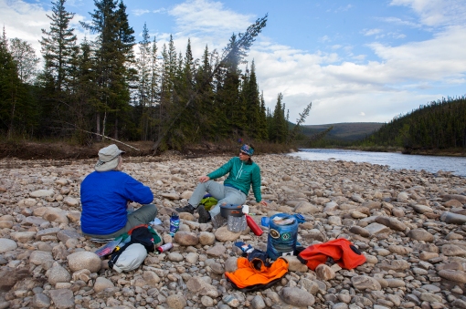
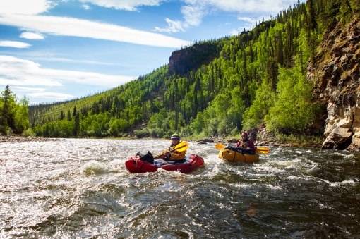
Late evening Alaska sun! We finished the 35 mile float in 8 hours, including stopping to cook dinner on a gravel bar.  We arrived at the Borealis LaFevre cabin well before we expected to. It was a great break from the bugs, which were getting worse & worse. Unfortunately, the area surrounding the cabin was trashed by previous users 😦 The cabin gets heavy use all year long, but we were disappointed that users hadn’t been taking care of it. We found the small window inside the cabin not seated properly, so it allowed mosquitos in….Kasey got the majority of the buzzing & bites, as she slept closest to the window. After a few bites, I burrowed down in my sleeping bag to get some relief. It was still much better to be inside the cabin than out, mosquito-wise!_J6A8712_J6A8749_J6A8757
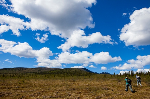
Tussocks! We found the winter trail and started our 20 mile hike through the swamp, tussocks, and burnt forest. After about a mile, we found a channel that we had to unpack our boats, re-inflate them, and paddle the short distance to the other side to continue our journey. IMG_3096IMG_2886
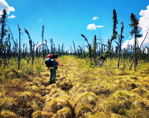
Eventually, we found the Summit Trail, which started off nicely-a boardwalk through the tundra! Which quickly turned into bushwhacking on the boardwalk, as the environment has taken over. Not too long after that, the boardwalk disappears, so does the faint trail & it’s climbing over downed trees from a previous fire & bushwhacking through alders at the same time. Occasionally, we would find the trail again for a short time. And follow it until it suddenly stopped. IMG_2895IMG_2903IMG_2910IMG_2918Wildflowers! They were starting to pop up everywhere! It was super hot & there wasn’t much water available (I got a little dehydrated). We eventually found small kettle ponds to purify water from. IMG_2923Eventually, we got to the easy ridge walking! We thought we might camp up high to (hopefully) avoid the majority of the mosquitos, but even on the ridges the mosquitos were bad. It felt like we had our own, personal clouds of them following us.IMG_2928IMG_2932We had originally thought we could do the 20 mile hike in one day (which can be done), but allotted two days. After a late start that morning, and lots of bushwhacking, we found the Summit Shelter unoccupied and in great condition, so we decided to stay there, instead of pressing on to the highway and getting to the truck at 1 AM.  It took us 9.5-10 hours to go 12 miles to the Summit Shelter. I think that’s a new record for slow 🙂IMG_4452_J6A8775
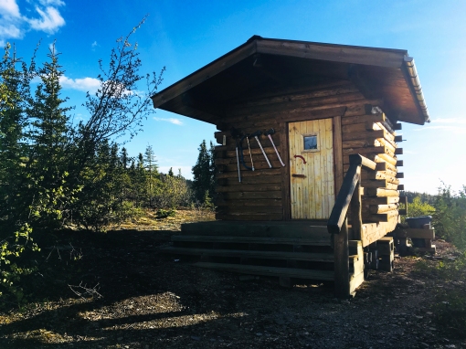
The 8 miles from the Summit Shelter to the Elliot Highway are easy, trail is in great shape (it’s well used, crazy difference between that part of the trail and the 12 miles between cabins). We had some post holing through snow, but it was almost a welcome relief from the hot sun 🙂IMG_2943


Dodging Boulders-The Charley River Trip

29 06 2017

Something happened which was truly amazing for Interior Alaska in the summer. By pure luck we managed almost 7.5 bug mosquito free days! Although, the last day and half of horrendous mosquitos made up for the previous victory…..

_MG_2309

The Charley starts at an elevation of approximately 4000 ft, dropping to 800 ft where it meets up with the Yukon. From the Three Fingers airstrip (on a tributary to the upper reaches of the Charley River) to the take out at Coal Creek it’s approximately a 125 mile float.

_MG_2493

Lisa dodging boulders on the tributary to the Charley.

We flew in the 3rd of June. Temps at the beginning where mid sixties during the day, dipping down to upper thirties at night. By the end, temperatures were crazy hot-soaring into the upper eighties during the day. Too hot to be in a tent at night, but to many mosquitos hatching not to be.

We had almost perfect weather everyday-but it quickly changes! Weather moves at lightning speed in the Interior. We had a few drops of rain one night, by morning our tent was bone dry. It did rain on the upper river, causing the river to go up a few inches one or two nights. But the rest of the trip the river dropped due to the heat & no rain-6 inches we were told it dropped at Gavin’s.

_MG_2534

Aufeis on the tributary. Lots of aufeis. We were fortunate we didn’t have to portage around any of it. Water levels looked average overall to us on both the tributary and the Charley. With lower flow on the tributary it took us almost two days to get to the Charley. When we arrived at the Charley we easily made up the time on the tributary.

_MG_2578

Lisa making a splash. The tributary was super fun Class 2 boulder dodging.

_MG_2605

Mary on one of the more technical rapids on the tributary.

_MG_2636-1

Lisa on the same rapid.

_MG_2666

Camping on the Charley. Endless campsites above the canyon, as well as, the lower river.

_MG_2653

_MG_2679

Wildflowers were just starting to bloom! Loads of them everywhere. Lupine.

_MG_2747

_MG_2860

_MG_2875

_MG_2890

Hiking to the B-24 bomber. We found easy hiking up 5510 Mountain from downriver of Gavin’s. Less swampy & luckily no bugs! More information on the crash: https://www.nps.gov/yuch/learn/historyculture/leon-crane-survival-story.htm

_MG_3117

_MG_3240

Trees starting to reclaim the crash site.

_MG_3255

I had my camera safely packed away for the Class 3 canyon (and a bit beyond). I regret not bringing a waterproof camera too! The canyon was fun & full of boulders, with the first rapid and second being the more challenging. The rest of the river is Class 2/2+. Fun boulder dodging and splashiness! Right after the canyon, we had a caribou swim right in front of our boats, get on the other shore, take one whiff and hightail it back behind our boats to the other shore. Pretty awesome. Overall, we saw 4 caribou, loads of dall sheep, and crazy amounts of birds-swallows, eagles, peregrines, etc.

_MG_3336_MG_3388_MG_3397_MG_3474

_MG_3532

I love eating good on river trips! Cashew chicken coconut curry I dehydrated at home for the trip.

_MG_3535

Pretty amazing sunsets that led into sunrises. EVERY NIGHT. This is 1:15 AM.

_MG_3559_MG_3575_MG_3604_MG_3671_MG_3726

_MG_3794

The lower river. Pure easiness. We were surprised at how much ground we were covering since it felt like we were barely moving. 

_MG_3801

_MG_3809

Wolf tracks on EVERY beach. Wasn’t lucky enough to see one though. Lots of bear track too.

_MG_3842_MG_3880

_MG_3965

Made it to the Yukon!

We pulled out at Slaven’s Roadhouse on Coal Creek for our pickup. We weren’t sure what to expect-but it’s definitely a historical place not to miss! The National Park Service has done a great job restoring it. We lucked out and had the place to ourselves-no camping the last night-box spring mattresses & a roof over our head! Which was great cause the mosquitos were horrendous 🙂 We hiked out to the Coal Creek dredge that is in the process of being restored.

_MG_4082_MG_4055_MG_4071

_MG_4165

One last amazing sunset! Yukon River, 2 AM.

_MG_4182

Lots of ice chunks bigger than cars line the sides of the river.

_MG_4233

A rainbow with the pot of gold-Slaven’s Roadhouse.


East Fork Chulitna-Mistakes Made & Lessons Learned

18 06 2015

I’m not sure why, but every time we start these trips, we try and avoid getting our feet wet at all costs, knowing full well it’s just a matter of time (and usually sooner than later) that our feet will be soaked. In the first 1/4 mile we ran into a large puddle/pond in the four wheel trail and bushwhacked around it. This was the first (and really only) bushwhack of the first day….Less than 20 minutes later our feet were soaked for the duration of the trip.

After going through bushwhack hell on the last trip using the Hardage Creek Route, we decided to take the northern route this time-we’ve seen great reports of little bushwhacking and decided to give it a try.

Beautiful views of Denali and the Alaska Range. Another amazing, sunny, warm weekend in Alaska.denali view beginning

After we left the easiness of the four-wheeler trails, we found some great high alpine game trails.

Boone hiking up towards the pass.

boone hiking

Jeff & Sarah climbing towards the pass.

sarah & jeff hiking

After reaching the pass, we looked at the map. Previous packrafters had taken the ridge left (headed slightly farther upriver), descended towards the creek, then made another pass before getting to the East Fork Chulitna near Crooked Creek. The East Fork Chulitna seemed so close! We decided to roll the dice & try our own route, knowing quite well the odds were greatly against us. Crazy thing is we succeeded 🙂 By doing this, we probably cut 3 miles off the hiking portion of the trip and only sacrificed about 1/2 mile of floating. We decided to stay high, traversing the ridge right.

Boone & Kasey.

 kasey and boone hiking

We started descending the nose & found a good place to take a break and fuel up before what we thought potentially could be a long bushwhack to the river. Here’s the view looking up river to Crooked Creek area. Once we descended to the valley floor, we wound up hiking in the general direction of up river, ending about 1/2 mile below the confluence of Crooked Creek.

checking maps

View down river & faintly the Alaska Range.

 group view of valley

We managed to find a route down, all tundra hiking. From the top we scouted several treeless areas & headed towards the first one. We easily linked up open areas with animal trails through the trees. It was definitely not a bushwhack. We even found a large downed tree to cross the creek on.

Sarah heading down the nose.

   sarah hiking down

Camp! I love Alaskan summers! I took this at 10:30 pm.

camp

Our put-in to the East Fork Chulitna.

yak

The first few miles of the paddle went smoothly. Fun, Class 2. Splashy. I’ve done this paddle before and loved it. The two canyons were challenging and the rest was pure easy fun. I led the paddle into the first canyon-a Class 3/3+ canyon. After making the first few rapids, I made a costly mistake-I got to close to a boulder, got high sided, from which I couldn’t recover and went for the swim of my life. I’m not sure if it was complacency  or just the littlest/giant mistake. Going into that rapid, I thought I had it. There wasn’t even a question in my mind. Now, instantly, I knew I was in pretty big trouble. There are few small eddies in the canyon, mostly rock walls, and I had 3 big drops to go & probably 125 yards till the river calmed back down to a fast Class 2.

I managed to hang on to my raft and my paddle, trying desperately to right my raft & when eddies appeared swimming desperately for them. I was almost able to catch one or two before the current grabbed me & threw me into another rapid. I was being thrown into boulders & over drops, getting pushed underwater, then being able to come up for air in time for the next one. My crew was desperately trying to catch me & help, doing everything possible. At one point, Kasey got to me, but I was unable to get close enough to her to grab her boat before we got separated in a rapid. Finally, my boat got caught on a large boulder (upside down) in an impossible place in the river. Boone caught up with me at some point & I was able to grab onto him for a second before we came upon the next rapid and had to let go. I was absolutely exhausted and knew I had to keep fighting. I kept swimming with my paddle, the river tossing me around like Raggedy Ann, with my head headed straight into a boulder. I narrowly missed bashing in my skull (how I don’t know, I was suprised-Boone saw it and was trying to figure out how he was going to get me unconscious or dead out of the river.) Regretfully, I had left my helmet at home. Definitely, won’t be doing that on future trips. Finally, I dumped out of the canyon into Class 2. The river isn’t terribly deep here-knee to mid thigh-just super fast. Boone managed to get to me, with Jeff right behind him. I grabbed onto the rope on the rear of his boat and he managed (I don’t know how) to get us to shore-NOT in an eddy (He said it was like dragging 3 boats). He jumped out of his boat, grabbed me with one hand & his boat with the other hand. I was so exhausted I couldn’t walk. I laid on shore breathing hard & exhausted-happy to be alive.

My hands were frozen-screaming barfie style, but the rest of me was relatively warm & dry. I felt like I had been through Fight Club-exhausted, my legs were so beat up-deeply bruised muscles, with visible ones on the surface (some bigger than my hand), as well as some good gashes. But I was ok. I did get a hole in my brand new Stowaway Tough drysuit by Alpacka-although, I truly believe this would have happened in my regular Kokatat drysuit as well. My long underwear was also ripped and I had a gash in my knee where the drysuit was ripped. I stayed pretty dry despite the hole. In the end, my pack broke the Packtach rope in half from the water pressure & floated downstream. Boone was able to jump in his boat & grab it. The pack coming off knocked the boat off the boulder into an eddy. Kasey & Sarah had managed to eddy out and grab it. Also, it happened to be one of the fewer parts of the canyon they could hike out of-so they packed up everything & hiked out to us.  I was so happy to see them.

Since I was to exhausted to boat the second canyon, (and the big class 3/4) rap, we had to hike around it (maybe 1 or 1 1/2 miles). I mean bushwhack. It was the hardest hike ever due to my legs being completely sore & beat up. My muscles barely wanted to put one foot in front of the other, much less with a pack & climbing over hills.  Thankfully, my crew grabbed my boat, paddle & pfd to take some weight off my back. Sometime after the big rapid, we managed to hike down to the river & paddle the rest of the trip. The rest of the float is a fun, splashy Class 2 all the way back to the highway. Although, I tried to enjoy the rest of the paddle, and definitely had some good moments, it just wasn’t the same for me. We got back to the car a few hours later than we expected due to the swim, and ended up getting “stuck” in Talkeetna, due to the Sockeye fire in Willow. It was 80F and a good place to chill out, relax, & reflect over a few beers on the banks of the Talkeetna River with the sun setting over Denali.
sunset denali talkeetna


East Fork Susitna

8 07 2014

Our Fourth of July trip started out car camping the night before beginning our pack raft trip on the Denali Highway. From my tent, I hear Dan ask Dylan if he smelled anything. Dylan replied “No.” Next morning, I caught a whiff of a horrible smell & noticed flies outside my tent. Dan happened to be walking by and I asked him if anything was dead outside. He replied “No, why do you ask?” A few minutes later Dan discovered a very dead porcupine out in the open between our tents! I have no clue how we missed it…..I would love to say it’s because we set our tents up at midnight the night before, but everyone knows there’s still plenty of daylight at midnight on the Fourth of July.

I finally got to finish a trip I started a few Fourth of July’s ago-packrafting the East Fork Susitna. Last time, a wall of weather led us to shorten our trip and change it midway through the first pass to Clearwater Creek (the weather to the East was significantly better). This time, we had 75f+ weather and nothing but sunshine! Dan, Dylan, and I hiked 35 miles & pack rafted 32 miles over 3 days. Although this trip can be done with a ten mile shorter hike, we ended up only driving one car, making hiking up Valdez Creek Mine road necessary. We couldn’t justify driving 2 trucks (you need four wheel drive and clearance for creek crossings on Valdez Creek Mine road) 5 hours to the put-in for 3 people…..


Dylan relaxing at Grogg Lake.

dylan grogg lake

Dylan & Dan hike over the first pass. There was a ton more snow than we expected from our past trip through this area to Clearwater Creek. Loads of post holing….brought back not so fond recent memories of our Puddingstone/Chickaloon trip. Also, due to recent heavy rains all the creek crossings were pretty high, with a stronger current. We stopped not long after this a short dinner break and had a herd of caribou bulls approach us. Once they came around the corner & saw us (they were 50ish feet away) they fled-I only got one crappy picture but it was super cool to witness.

first pass

Dan crossing a snowfield in the first pass. It seemed like half the snow fields were just hard enough to support us, the other half we post holed through. It wasn’t consistent with aspect, as we expected it to be.

dan snow

The amazing Mid. Best pack rafting tent ever!

mid

Dan & Dylan checking out the route from the end of the first pass. There was no shortage of snow or boulders on this trip!

dan & dylan over the pass

View from the top. Crossing yet another snow field.

over the pass

Dylan & Dan taking a break with Mt. Deborah peaking over our next pass. Boulder creek is in between.

dan dylan deborah

Dan Dylan hike

Up the last pass. Very similar looking to Hatcher’s Pass, just with caribou 🙂 I dubbed this Caribou Pass, there were tons of them up here-all mamas & babies. We saw tons of caribou, marmot, ground squirrels, and ptarmigan. Some wolf scat & a bear print, but no actual sighting of the predators.

caribou pass

A few ‘Bou.

a few bou

The East Fork Susitna is all Class I, with a Class III section in the first half. We lucked out with high water and had very little butt dragging on gravel bars.

Beautiful views as far as the eye could see! We had hot, amazing weather until the last four hours…..the wind picked up significantly, pushing us around in our little pack rafts. Fighting the headwind slowed us down to a crawl. Also, it made it impossible to see the butt dragging gravel bars slightly under water, and the river looked much more like a choppy ocean than a smooth Class 1 river. The last 15 minutes we got absolutely poured on, but on the plus side, the wind subsided :).

dan paddle


Sable Pass-Calico Creek-Sanctuary River

3 07 2014

We got a very late start on the trip. I forgot what a hassle dealing with getting a backcountry permit in Denali & viewing videos. It took forever. We had to wait for everyone else (3 other groups) to figure out where they wanted to go first, before we could all watch the video together. Ahhh, love dealing with all the bureaucracy of the park service. We then raced to buy bus tickets and were able to jump on the 2 o’clock camper bus. A small victory. Until the bus broke down at Savage River. Delayed us for another 1 hour +. At Savage, I got attacked by sea gulls while waiting for the new bus. Of all the things that could go wrong on a packrafting trip in Denali,  I didn’t anticipate sea gulls as being a threat. I’m not a fan of birds to begin with (unless they are on my plate), and I was attacked twice! By four different birds! I think they knew I have a vendetta against birds……At Savage the two birds started dive bombing me (I was eating my sandwich), they stole it out of my hands while I was taking a bite! Even after they got my sandwich they kept coming back and trying to attack me. So far, the trip isn’t off to a good start…..

Kasey & Ryan at the beginning of the trip. Kasey is holding up five fingers, indicating we started the trip at 5 o’clock. Technically it was more like 4:45…..

5 o clock

The hassle of getting a backcountry permit was well worth it. I never get tired of the amazing views in Denali.

reflection

scenery

As we made our way up the Teklanika River, Ryan & I got attacked by sea gulls again! They dive bombed me with talons out! Ryan thought it was funny, I, not so much. The first sea gulls must have told these guys about my great sandwich……

Nice rack! Caribou skull & rack at Calico creek. The hiking was top notch. I love high tundra hiking! We saw 10-12 sheep lying down on the tundra at Calico creek. The hiking was fairly easy with breathtaking views!

Nice Rack

My tent. I love the Mid! And Alaska summers-this is at 11:30 pm!

tent

Another shot. Sun is nowhere close to being down.

tent sunset

Kasey studying the map at the pass, dropping into Sanctuary.

kasey map

We got to glissade/sled much of the way down the pass! Our butts got numb from sledding, so after awhile, Kasey & Ryan decided to use their packs as a sleds.kasey sledding

My Yak. Love, love the new big butt & whitewater spray skirt! This is the river that flows out of Refuge Valley & into the Sanctuary River. We lucked out with fantastic weather!

my yak

Kasey taking off into the Sanctuary. River levels were pretty high, but not flooding like the rivers farther east in the Park. It made for a fast float out-about 3 hours from put-in to take-out.

Kasey paddling

Kasey & Ryan. Gorgeous trip! Although, I think I only have patience to deal with the park service once a year.  🙂

kasey ryan paddle


Chickaloon River (the hard way) via Puddingstone Mountain

29 05 2014

 I’ll be the first to NOT recommend the hiking portion. At least the backside of Puddingstone Mtn. I’m not sure it even qualifies as Type 2 fun. On the other hand, the Chickaloon River is a super fun, splashy float! With below average water flow it was Class 2 most of the way, with Class 3 sections above & below Hotel Rocks and the one final drop before the highway.

Our original planned packrafting Memorial Day/Kasey’s 30th birthday trip got derailed by low water. So Friday night, the six of us were sitting around at Ryan’s family’s house in Chickaloon studying maps and looking for a new trip. Ryan’s dad suggested that if we were “badasses” we could start hiking up the atv trails at Purinton, then wrap around the backside of Puddingstone Mountain (the pass is approximately 4000 ft) and then drop down to the Chickaloon River to float out. Seemed easy enough. Admittedly, I didn’t study the map that well. In fact, since I have the WORST sense of direction, and easily get lost (even with a map, even in places I’ve been before-for some reason rocks, trees, and mountains all look the same to me 🙂 ), I usually rely upon friends to help me navigate the backcountry. That being said the map indicated a “historic trail” which we were hoping to use. Actually, we did use it and it was great. Until we couldn’t anymore……….

We even were thinking that although we had originally planned for a 3 day trip, this is easily a 2 day trip…….Glad I left most of the extra food in my pack 🙂

Dan found mud on the ATV trails at Purinton 🙂

Dan Mud

 It was super smoky from the Funny River fire burning on the Kenai. Dan’s hiking in front of Anthracite ridge, which is barely visible with all the smoke.

dan hike smoke

Dinner at Boulder Creek. We took a pretty relaxed approach on Saturday, late start, early camp. We camped near here since it looked like the best place before the pass. Little did we know what Sunday Funday had in store for us……

dinner at Boulder creek

Smoky sun.

smokey sun tents

Kasey & Dan on the approach to the pass behind Puddingstone Mtn. We found easy atv trails that turned into game trails on the other side of Boulder Creek, then high tundra made for a pretty nice hike on this side of the pass. I didn’t look closely at the map and figured the other side was the same…..not so much.

dan kasey hike

Kasey and Sarah with the creek valley down below.

kasey sara hike

Once we reached the pass, the other side was snowfields galore! And it was all rotten, deep snow. We tried to sled (worked for a few feet), postholed up to our hips, and tried to roll across the snow. We looked completely ridiculous. Unfortunately, I didn’t take a good picture of the backside of the pass. It ends up dropping off significantly, with two choices to head down. One, being a snow gulley (We were reluctant with freezing feet & given the snow conditions we had just been through. Plus there was a cornice to negotiate). The second was a steeper angle down the front with loose rock over hardpack rock & dirt-which meant one-at-a-time could head down safely. Kasey, Dan & I found a way onto the snow gulley and headed down that way, while Dylan, Sarah, & Jeff took the nose down. We beat them by a long shot-the snow in the gulley was just hard enough, and had enough debris, to support our weight. We enjoyed a pretty easy descent. So far trip = good. Still thinking we could float today. Or, at the very least make it to the river early, set up camp, & enjoy some whiskey to celebrate Kasey’s 30th birthday.

Then came the rest of the trip to the Chickaloon. We started down the valley in the creek, crossing every ten feet it seemed. Not difficult hiking, but we weren’t making tons of progress either. The “historic trail” on the map indicated we climb 2000 ft up to the mountain on the right (across from Dan, Kasey, and Dylan in the picture below.) We realized historically they were mining, but I still have no idea how they crossed some of the ravines. Also, we found many 90-99 ft “cliffs” not indicated on the map (the elevation lines being every 100 ft.) The creek started descending and getting larger from tributaries, so we made the choice to bushwhack/climb straight up through alders to a clearing and reassess the situation. We came to some realizations. We couldn’t continue down the creek bed. Over the next mile would lose 1600 ft in elevation (waterfall) and the sides of the creek were getting cliff like. We could either try and gain the ridge on Puddingstone (another 1600-1800 ft elevation gain) and hopefully get down it (the map indicated it was super steep and this seemed really questionable) or return the way we came back over the pass which seemed like a horrible idea. We could see the Chickaloon about 2 miles away ish and really wanted to float! Not to mention, going back through the pass seemed a daunting task. We kept hiking to the ridge and the only spot we could see to camp for several miles in either direction-a little saddle on the ridge. I didn’t like this idea since it was so exposed, but there weren’t any other choices at this point. Here we are stopped for a quick dinner to fuel up for the rest of the hike up to the ridge.

cooking dinner

Gorgeous views on top of the ridge. Dylan, Dan, and Kasey looking at our options. The nose of the ridge dropped off quickly into cliffs. We explored a lot of options for an hour and a half off the end of the ridge and couldn’t find a way down. The other side of the ridge made a more gentle drop to the next valley, except the last 80 ft or so dropped off sharply too. We went to bed that night not sure if we could pick our way down into the next valley or had to do a death march back the way we came. I was super exhausted that night and morale was a little low even toying with the idea of hiking back over the pass. Plus, we were wondering if we’d be able to do it in one day with our heavy packs. I had barely just enough food for a full third day, and I kept thinking of the “extra food” I left in the car since it was just supposed to be an overnight trip……

checking options

The next morning we woke early, and were able to descend down to the next valley. To do this we had to descend up into the valley (going the opposite direction from the river). We were sooo excited! We’d get to the Chickaloon after all! We picked our way down the creek slowly, again crossing every ten feet over slippery rock, until again we had to gain the next ridge because this creek too dropped significantly. Looking back on the ridge we camped, there were one or two ways down it, but it mostly cliffed out. So glad we lucked out and found an easier way down. We climbed a snow gulley and gained the next ridge. A little more vertical climbing than I thought we would be doing on this trip 🙂 We knew the next ridge had a plateau, then had a more gentle slope down. We then found a nice game trail and hiked easily on it until we ran into this little guy. No mama in sight and he was crying & barely walking. He appeared to be about the same size as a german shepherd, less than a week old and pretty frail. Unfortunately, there wasn’t anything we could do for him and most likely his mama was dead. I’ve never seen a moose baby this young without mom being within 10 feet at most. Also, we were worried about bears in case she was dead in the area. It was sad.

baby moose 2

We left the game trail and started the easiest bushwhack I’ve ever done down to the river. Yay! The Chickaloon! We had a fun float out-such a great river!A few of us went for a refreshing swim in it:)  An adventure for sure, and a lesson or two learned 🙂

the Chickaloon!


East Fork Chulitna-The Hardage Creek Route

23 07 2013

This is the BEST SUMMER EVER in Alaska. Hot and sunny. Blue Skies. It’s the summer I’ve always dreamed of, but only got to experience in bits and pieces in the past.

The East Fork Chulitna should be on every packrafter’s list of to do’s. Heading up the (southern) Hardage Creek route, you definitely work for every ounce of it, but the beautiful scenery and float out is worth it! That being said, I think I’ll check out the northern route to the river next time…..

sign

Easy hiking on the muskeg up the power line. At some points the muskeg was so bouncy it felt like a trampoline. Initially, we were skeptical to abandon the easiness of the power line to penetrate the thick spruce and find the atv trail to the east. Surprisingly, this bushwhack was super easy and actually not much of a bushwhack…..

powerline

Wildflowers were abundant! Lupine and wild irises were still in bloom. Fireweed, monks hood, bluebells, and loads other flowers (as well as cow parsnip) blanketed the hillsides.

dylan fireweed

Looking down on the Hardage Creek valley. To the left of the image (headed up valley) the valley is completely choked with alders and no real open spots. After much debate, we opted to climb above the crazy bushwhack below, hoping our elevation would save us the frustration of the bushwhack and be easier. It was NOT a good idea. I’m not sure what would be a good route through this area, but going high was brutal. We were side-hilling 45-50 degree slopes (my ankle was not so happy), with some bushwhacking,  it ended up taking us approximately 4 hours to go 2 miles. We ended up having to drop down and do some more bushwhacking to the creek anyway, then hike up the other side once we neared the moraine, so going high, unfortunately, had no advantage. 😦

the bushwhack maze

Dylan taking a break on our hike up the Hardage Creek valley.

taking a break

Dylan checking the map, while I cooked dinner. Each doing what we do best 🙂 Without friends with good map skills I’d probably still be out there 🙂

checking map

A curious caribou kept approaching us, then prancing off. He was super fun to watch.

caribou

Headed up into the rocky moraine. In the middle of the photo, right where the closer hill meets the mountains in the back is the pass. It was a pretty awful, sketchy climb. One step forward, two back. Kicking down loose rocks (we had to each climb up separately as to not kick rocks on each other), and the even walls were not stable with deep cracks. We managed to pull a large suitcase size part of the wall down.

shadows looking up to pass

The descent to the other side of the pass was super easy. Long chutes of shale made for an easy and fun descent. We ran into a herd of 25 caribou in the valley. Super fun to see. Once they caught wind of us, they hightailed it over a pass.

valley

Plentiful camping opportunities every mile or two from here to the river. For the most part, this part of the hike was easy tundra hiking, following game trails through the brush. Although, there was some bushwhacking (especially the last mile to the river) and we did have a few creek and drainage crossings that were interesting 🙂

The Chulitna!!!! We put in about a mile or so above the Crooked Creek drainage. We were happy to (finally) be in our boats!

put in

The whole length of the river the scenery was stunning. When we started paddling the Chulitna is a flat, windy river with spawning salmon racing up river, and a curious caribou with a gorgeous rack, that followed us down river. When Crooked Creek dumps in the Chulitna picks up the pace and gets fun & splashy, but an easy Class 1 & 2. The first canyon is by far the hardest (Class 3), with some big drops! I wound up with an amazing amount of water in my boat, making it super unstable. I was able to eddy out in the canyon (luckily) and dump my super heavy-with-water boat out. We were able to scout the big rapid (Class 3+) at the start of the second canyon and ran it without any problems. It was super fun! The rest of the canyon is much easier than the first. From there on out it’s a fun, 1 hour 20 minute, bouncy Class 2, float out to the highway. Definitely my favorite float to date!

early river


Carlo Creek to the Nenana

7 08 2012

 Eva, Dan, and I met Katie and Will at Carlo Creek to do the Coffee/Pizza packraft. Starting out with coffee at Carlo Creek and ending with pizza and beer at Panoramic Pizza, it’s a perfect way to begin and end a trip. It’s a 15 mile hike in up Carlo Creek, then a 15 mile float out on the Nenana. The Denali area this time of year is gorgeous, wildflowers are abundant, I was stoked to be doing another trip up there. And, this is our last trip with Katie and Will before they move to Wisconsin so Will can finish his PHD.  

Katie, Eva, and Dan on the hike in.

 Alaska cotton.

Katie and Will hiking up the Carlo Creek valley past this turquiose mountain lake. Carlo creek is a crazy, beautiful blue color, like this lake. This part of the hike was really easy, and we found tons of game trails.

Will enjoying the blue skies and sunshine.

No short supply of wildflowers!

Katie crossing Carlo Creek.

Looking back down valley. Once the valley turns to the south, the easy boulders begin. 

My over confidence of how easy the hike was drastically changed when I saw the bouder field we had to climb. After climbing most the way up it, here Katie is crossing a snowfield just short of the pass. And another stunning blue lake, that in late July, the ice was just now breaking up on. This part of the hike would be crazy treacherous if the rocks were wet.  

The view from the pass. Just when we were hoping never to see another boulder-holy boulder field! The fun was obviously just beginning…..

Katie and Will wrapped in a sleeping bag on our dinner break. The winds had really kicked up, and it went from a tank top and shorts kind of day to where the heck is my puffy jacket kind of day rather quickly.

Once we decended to the bench, I ran into a large caribou that mistook my paddles sticking out of my pack for antlers wagging at him. I took my pack off as quick as I could once I realized what was going on and he kicked up some tundra with his back legs staring right at me! Unfortunately, no pic, cause this was one of the rare occurances where my camera was in my pack 😦

We had crazy winds that were constantly changing direction all night. And we woke up to the pass being socked in. Very glad our tents held up to the abuse, and that we made the pass the day before in clear, dry conditions.

The crew on the Nenana. I never imagined I’d do a seal launch in my packraft, but I did on the Nenana. Not seeing a gravel bar or eddie in sight, after careful inspection of the grass for sharp rocks or twigs, I hopped off into the river.

Katie, Eva, and Dan enjoying the splash of sun we got the next day.

The Nenana (for the most part) is a really easy Class I. Right after the river turns north and you cross the Parks highway there is a fun, splashy section of class II.


Packrafting Savage to Sanctuary Rivers, Denali National Park

27 07 2012

I was not excited about the 80% rain I saw in the forecast as I was grabbing my backpack and headed out the door. After a super cold and dreary summer, one more trip in the rain didn’t sound as appealing. Luckily, we scored and had more sun than rain, and the weather held for the most part.

All told, Dylan and I had 15 miles of backpacking up the Savage River valley on over to the Sanctuary River and a 16 mile float out. We did it in about 8.5 hours hiking and 2.5 hours of packrafting. We managed to find nice “social” trails in the first part of our hike, then great moose/game trails all the way up the valley-it made for a really easy hike. The river was running high and fast (yay! no buttdragging!), we were surprised to finish floating it so quickly.

The Savage River valley was littered with moose antlers, and the Sanctuary valley was equally littered with caribou antlers. This moose antler had been chewed on by a bear. Later, we did come across a year-ish old moose kill sight-that bear did an excellent job levelling the tundra and excavating the site. Still was enough of a deterent for us to hike around it…

Dwarf fireweed (and a whole lot of other wildflowers) were out in abundance.

Eventually the trails lead to nice gravel bars to hike up valley on. Dylan crossing over to one.

A very blond, and quite large grizzly that we came across. He sat and watched us for a while, then meandered off. 

Near the head of Savage valley. The pass is to the very right in this image, just right of the triangle peak. We opted to hike up and over the mountain cut off on the ride side of the pic, instead of the pass that was full of questionable snow and shale. We found it to be a pretty good approach. Staying high and right on this mountain made it a pretty easy hike down to the river.

The Sanctuary River.

My raft at the put-in on the Sanctuary River. The sun broke out just as we got there. Skies cleared (mostly) downstream, while a crazy rain and wind storm was on our tails chasing us (but never catching us) down valley to the park road.

Yeah, this really happened two minutes into our float. It was pretty freakin’ sweet!

Then twenty minutes later we came upon this very, very fresh kill. Probably dinner the night before for the wolves that have a den in an area closed of nearby.

Scenery along the way.

Dylan. The river was Class I, with maybe a little easy Class II thrown in. Fun and a little splashy, but nothing to technical. And crazy, beautiful, amazing scenery along the way.

A pretty sweet trip!


The Brooks Range Trip: Part 3-Arrigetch Creek to Takahula Lake

26 08 2011

We got back on the Alatna River on day seven, the same day we came out of the Arrigetch. We were welcomed by sunshine and warm temps! It was great to dry our gear out after a few soggy days in the mountains. We decided to put in a few miles before making camp for the night. Luckily, that night we saw a family of wolves! Unfortunately, I didn’t get a pic, but we caught glimpses of a full size adult silver colored wolf, and a good look at a wolf pup/adolescent in and out of the brush along the riverbank. Definitely a highlight of the trip!

The Alatna River widens quite a bit right before Arrigetch Creek into a faster flowing Class 1. At one point, Boone clocked us on his GPS  at moving 6.7 mph, and I wouldn’t be suprised if in a few areas we moved a little faster. With all the rain that the lower river had received it was muddy, and running high.

Kasey doing the worm on our last beach we camped at.

Kasey tending the fire.

Fall colors were just starting to appear.

The last morning, Day 8, started out with high clouds, quickly breaking to warm sunshine.

Boone and Dan headed down river.

Kasey.

Kasey and Dan in the sun!

The take out from the Alatna river. Like most mud/sand we found along the river it had bear tracks. Throughout our time on the Alatna it seemed that most beaches/mudbars had bear, wolf, and a few caribou tracks. From here we had a short portage to Takahula Lake, then a paddle across the lake to the pick-up beach.

Kasey and Boone on the beautiful Takahula Lake.

Takahula Lake! The sea green water looks like the Carribean! We couldn’t help ourselves. We swam. It was less warm than the Carribean 🙂