Beaver Creek – Summit (no) Trail

19 06 2018

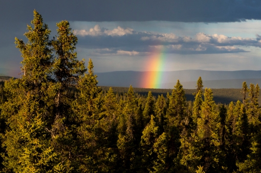
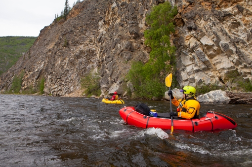
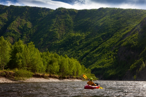
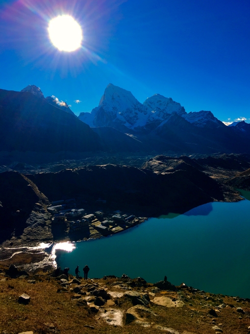
Kasey and I decided to take advantage of an early (hot) June weekend and explore her new stomping grounds in Fairbanks. Beaver Creek is a National Wild & Scenic River just north of Fairbanks in the White Mountains with road access. We slept in and got a little bit of a late start-we put in for the 35 mile float starting at Nome Creek at 1 pm._J6A8588
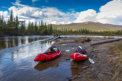
Beaver Creek is a Class 1 river that meanders through low, rolling mountains. It’s beautiful in every direction. _J6A8631_J6A8635
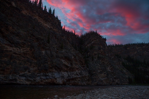
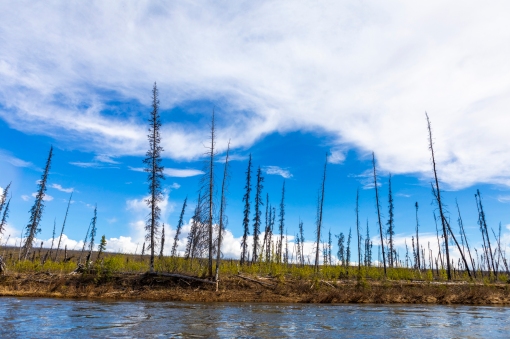
Lots of dead wood from previous forest fires. I love the interior weather-we had mostly hot & sunny, with thunderstorms rolling through at jet speed (which was a welcome temperature difference) and rolling out just as fast. We never got more than a couple drops of rain, however, surrounding us it looked like some areas were getting downpours._J6A8660_J6A8674_J6A8679
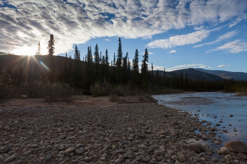
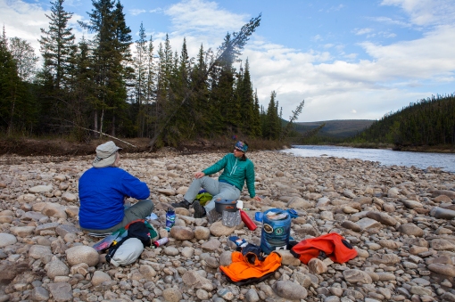
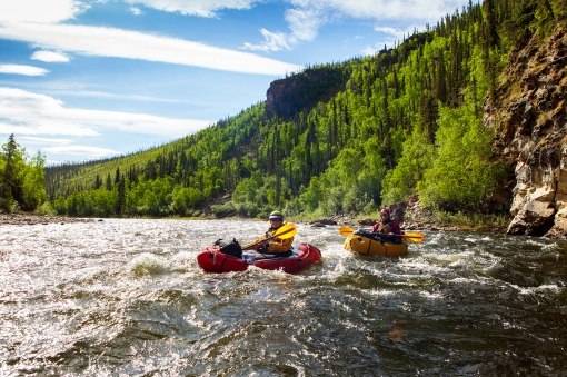
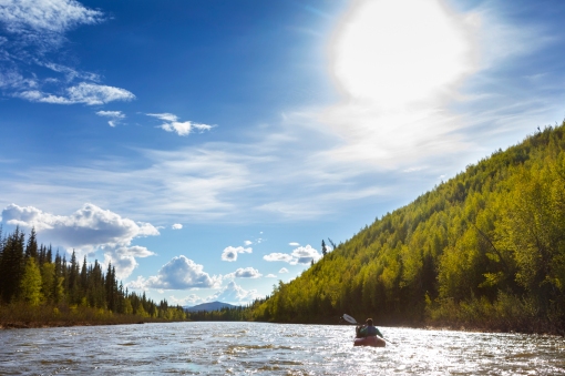
Late evening Alaska sun! We finished the 35 mile float in 8 hours, including stopping to cook dinner on a gravel bar.  We arrived at the Borealis LaFevre cabin well before we expected to. It was a great break from the bugs, which were getting worse & worse. Unfortunately, the area surrounding the cabin was trashed by previous users 😦 The cabin gets heavy use all year long, but we were disappointed that users hadn’t been taking care of it. We found the small window inside the cabin not seated properly, so it allowed mosquitos in….Kasey got the majority of the buzzing & bites, as she slept closest to the window. After a few bites, I burrowed down in my sleeping bag to get some relief. It was still much better to be inside the cabin than out, mosquito-wise!_J6A8712_J6A8749_J6A8757
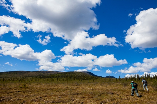
Tussocks! We found the winter trail and started our 20 mile hike through the swamp, tussocks, and burnt forest. After about a mile, we found a channel that we had to unpack our boats, re-inflate them, and paddle the short distance to the other side to continue our journey. IMG_3096IMG_2886
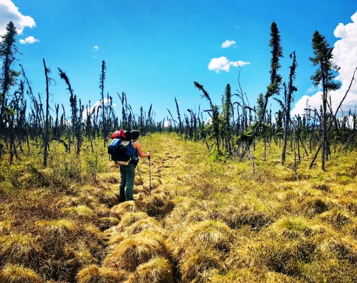
Eventually, we found the Summit Trail, which started off nicely-a boardwalk through the tundra! Which quickly turned into bushwhacking on the boardwalk, as the environment has taken over. Not too long after that, the boardwalk disappears, so does the faint trail & it’s climbing over downed trees from a previous fire & bushwhacking through alders at the same time. Occasionally, we would find the trail again for a short time. And follow it until it suddenly stopped. IMG_2895IMG_2903IMG_2910IMG_2918Wildflowers! They were starting to pop up everywhere! It was super hot & there wasn’t much water available (I got a little dehydrated). We eventually found small kettle ponds to purify water from. IMG_2923Eventually, we got to the easy ridge walking! We thought we might camp up high to (hopefully) avoid the majority of the mosquitos, but even on the ridges the mosquitos were bad. It felt like we had our own, personal clouds of them following us.IMG_2928IMG_2932We had originally thought we could do the 20 mile hike in one day (which can be done), but allotted two days. After a late start that morning, and lots of bushwhacking, we found the Summit Shelter unoccupied and in great condition, so we decided to stay there, instead of pressing on to the highway and getting to the truck at 1 AM.  It took us 9.5-10 hours to go 12 miles to the Summit Shelter. I think that’s a new record for slow 🙂IMG_4452_J6A8775
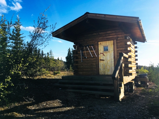
The 8 miles from the Summit Shelter to the Elliot Highway are easy, trail is in great shape (it’s well used, crazy difference between that part of the trail and the 12 miles between cabins). We had some post holing through snow, but it was almost a welcome relief from the hot sun 🙂IMG_2943


Dodging Boulders-The Charley River Trip

29 06 2017

Something happened which was truly amazing for Interior Alaska in the summer. By pure luck we managed almost 7.5 bug mosquito free days! Although, the last day and half of horrendous mosquitos made up for the previous victory…..

_MG_2309

The Charley starts at an elevation of approximately 4000 ft, dropping to 800 ft where it meets up with the Yukon. From the Three Fingers airstrip (on a tributary to the upper reaches of the Charley River) to the take out at Coal Creek it’s approximately a 125 mile float.

_MG_2493

Lisa dodging boulders on the tributary to the Charley.

We flew in the 3rd of June. Temps at the beginning where mid sixties during the day, dipping down to upper thirties at night. By the end, temperatures were crazy hot-soaring into the upper eighties during the day. Too hot to be in a tent at night, but to many mosquitos hatching not to be.

We had almost perfect weather everyday-but it quickly changes! Weather moves at lightning speed in the Interior. We had a few drops of rain one night, by morning our tent was bone dry. It did rain on the upper river, causing the river to go up a few inches one or two nights. But the rest of the trip the river dropped due to the heat & no rain-6 inches we were told it dropped at Gavin’s.

_MG_2534

Aufeis on the tributary. Lots of aufeis. We were fortunate we didn’t have to portage around any of it. Water levels looked average overall to us on both the tributary and the Charley. With lower flow on the tributary it took us almost two days to get to the Charley. When we arrived at the Charley we easily made up the time on the tributary.

_MG_2578

Lisa making a splash. The tributary was super fun Class 2 boulder dodging.

_MG_2605

Mary on one of the more technical rapids on the tributary.

_MG_2636-1

Lisa on the same rapid.

_MG_2666

Camping on the Charley. Endless campsites above the canyon, as well as, the lower river.

_MG_2653

_MG_2679

Wildflowers were just starting to bloom! Loads of them everywhere. Lupine.

_MG_2747

_MG_2860

_MG_2875

_MG_2890

Hiking to the B-24 bomber. We found easy hiking up 5510 Mountain from downriver of Gavin’s. Less swampy & luckily no bugs! More information on the crash: https://www.nps.gov/yuch/learn/historyculture/leon-crane-survival-story.htm

_MG_3117

_MG_3240

Trees starting to reclaim the crash site.

_MG_3255

I had my camera safely packed away for the Class 3 canyon (and a bit beyond). I regret not bringing a waterproof camera too! The canyon was fun & full of boulders, with the first rapid and second being the more challenging. The rest of the river is Class 2/2+. Fun boulder dodging and splashiness! Right after the canyon, we had a caribou swim right in front of our boats, get on the other shore, take one whiff and hightail it back behind our boats to the other shore. Pretty awesome. Overall, we saw 4 caribou, loads of dall sheep, and crazy amounts of birds-swallows, eagles, peregrines, etc.

_MG_3336_MG_3388_MG_3397_MG_3474

_MG_3532

I love eating good on river trips! Cashew chicken coconut curry I dehydrated at home for the trip.

_MG_3535

Pretty amazing sunsets that led into sunrises. EVERY NIGHT. This is 1:15 AM.

_MG_3559_MG_3575_MG_3604_MG_3671_MG_3726

_MG_3794

The lower river. Pure easiness. We were surprised at how much ground we were covering since it felt like we were barely moving. 

_MG_3801

_MG_3809

Wolf tracks on EVERY beach. Wasn’t lucky enough to see one though. Lots of bear track too.

_MG_3842_MG_3880

_MG_3965

Made it to the Yukon!

We pulled out at Slaven’s Roadhouse on Coal Creek for our pickup. We weren’t sure what to expect-but it’s definitely a historical place not to miss! The National Park Service has done a great job restoring it. We lucked out and had the place to ourselves-no camping the last night-box spring mattresses & a roof over our head! Which was great cause the mosquitos were horrendous 🙂 We hiked out to the Coal Creek dredge that is in the process of being restored.

_MG_4082_MG_4055_MG_4071

_MG_4165

One last amazing sunset! Yukon River, 2 AM.

_MG_4182

Lots of ice chunks bigger than cars line the sides of the river.

_MG_4233

A rainbow with the pot of gold-Slaven’s Roadhouse.


Nepal in Pictures

7 12 2016


_mg_1192

Kathmandu.

_mg_1303

Kalabhairava, Durbar Square, Kathmandu.

_mg_1340

Hand held prayer wheels for sale in market.

_mg_1375

Relics, Patan Museum, Durbar Square, Kathmandu.

_mg_1384

Patan Museum, Durbar Square, Kathmandu.

_mg_1437

Sadhu, Durbar Square, Kathmandu.

_mg_1575

Stupa at Monkey Temple.

_mg_1731

Macaque monkey.

_mg_1758

Baby macaque.

_mg_2016

Prayer boulder & Stupa on Gokyo trek.

_mg_1930

Prayer wheel.


img_0605


img_0799

Porters & their packs. Some of the hardest working people.

img_0918

Female herder & her cows on suspension bridge crossing the Dodh Kosi.

dudh

Last suspension bridges crossing the beautiful Dudh Kosi before the climb to Namche Bazaar.

_mg_2392

Rachael climbing out of Dole.

_mg_2708

Yak herder, yaks, fellow trekkers. Gokyo valley.

_mg_2715

Prayer flags, Himalayas.

_mg_2739

Young herder & his burros.

gokyo

Entering Gokyo & the third lake.

_mg_2882

Gokyo.

img_0899

Fuel cakes. Yak dung, Gokyo.

01

Abandoned Sherpa home.

fullsizerender2

Yaks, Ama Dablam, & Phortse.

_mg_2231

Monastery in Khunde.

_mg_2144

Fall colors near Khunde.

_mg_2061

Namche Bazaar.

lukla

Where the cows rule the streets. Lukla, Nepal.

_mg_3315

Cow. Pokhara, Nepal.

_mg_3739

World Peace Pagoda, Pokhara, Nepal.

_mg_3470

Paragliding, Pokhara.

_mg_3477

Paragliding, Sarangkot, Pokhara, Nepal.

_mg_3950

Paragliding over Pokhara.

DCIM802GOPRO

Me & my guide Deepak. So much fun!!!

One of the most amazing trips. Beautiful country, beautiful people.


Gokyo Trek, Nepal

23 11 2016

Nepal. Himalayas. Hell yes.

Despite all that is written about flying into Lukla (dubbed one of the most dangerous airports in the world-short runway, mountain on one side, cliff on the other, 11.7% gradient), we had a pretty uneventful, anticlimactic landing. Maybe I’m jaded from growing up in Alaska and riding in bush planes….That being said, everyone else on the airplane cheered when we landed  🙂

The trek took us 12 days, none of the days being very long-distance wise or a lot of elevation gain. However, it was the altitude that kicked our asses, backpacking at 9,000-15,500 feet.

Lukla.lukla

Living at sea level, landing in Lukla (9334 ft.) put me at almost the highest I’ve ever been. Rachael & I had quickly organized our gear and set off for Phakding.

Beautiful prayer wheels were abundant along the trek.

_mg_1930

On the way to Phakding. The first two days of the trek weather ranged from warm & sunny (60-65f) to cold & raging rains (40-45f). Everyone in the region commented that the monsoons were later this year than usual.

_mg_1931

Beautiful stupas and large boulders carved with prayers on them are commonplace along the trek.

_mg_2016

Much respect to the porters. They climb up and down the valley carrying crazy loads, no matter the weather. We repeatedly got passed along the trek by porters carrying 60-90 lbs wearing flip flops.

img_0799

One of many suspension bridges crossing the Dudh Kosi. Sharing the bridges with yaks, burros & cows felt like getting double bounced on a trampoline.

img_0918

The beautiful Dudh Kosi. A violent, raging, gorgeous river. This is the final suspension bridge crossing before the climb to Namche.

dudh

Namche Bazaar! Just above 11,000 ft. We stayed in this beautiful village a couple days to acclimatize. It was mostly foggy (this view was rare), wet, and cold-about 40-45f. Pemba Sherpa & his staff at the Khumbu Lodge treated us like family.

_mg_2061

We spent one of our “rest” days climbing up to Kunde & Khumjung. Khumjung is the largest Sherpa village in the region, and where many people higher up on the trek live in the off season. Everyone was so welcoming! We got invited into an older woman’s house for tea, where she told us stories & shared her potatoes with us. Afterwards, she took us on a “short-cut” to the bakery, hoping over stone walls and almost running so fast where we could barely keep up with her!

Young boys making faces at us 🙂

_mg_2265

The monestary in Kunde.

_mg_2244

Fall colors.

_mg_2144

Much of the next few days were spent again in a fog & cold. This is actually good visibility. Mostly, we could only see about 10-15 feet in front of us.

_mg_2317

Rachael climbing out of Dole. Brief window of sun, before more clouds & rain. Weather typically was nicer in the morning, then clouds and rain would roll in by early afternoon.

_mg_2392

Young Sherpa girl.

_mg_2439

_mg_2462

Yak dung drying. Yak dung is the fuel that heats every tea house in the region.

_mg_2525

Prayer tablets at Machermo. We escaped the rain and upper 20/lower 30f weather and went to a altitude sickness talk at the local clinic. Super informative & worth the time! Machermo is at 14,600 feet-it’s typically where altitude sickness starts affecting some people. Everyday on the trek, we heard helicopters buzzing up and down the valley, many carrying patients back to Kathmandu. The doctors in Machermo said that they would have 1-2 patients fly out per day. Gokyo had many more leaving by heli.

_mg_2527

After pouring rain all night, we woke up to blue skies, fresh snow on the peaks & sun!

_mg_2542

We finally had great visibility & sun! The views were stunning in every direction!

_mg_2708

_mg_2715

Cho Oyo.


_mg_2658

Young herder.


_mg_2739

_mg_2774

Rock cairns at the first lake. Cairns are viewed as makeshift stupas and everywhere in the Gokyo region. The five lakes in the Gokyo region are sacred places to the Nepalese. The Gokyo area reminded me of Alaska on steroids-stunningly beautiful, with 8,000 meter peaks, prayer flags, and yaks!


_mg_2788

Entering the third lake & Gokyo (15,500 ft). This area was so unbelievably gorgeous, it’s no wonder it’s considered sacred.


gokyo

Although, I got a touch of altitude sickness once we got to Gokyo (which I was able to solve with medicine), Rachael really suffered. On top of that, we both had acquired horrible sinus infections in Namche (which stayed with us for the rest of the trip) and the Khumbu cough (which lasted much longer than the trip 😦 ). We stayed at the Fitz Roy-They were amazing & so helpful, checking in on us, sending up pots of hot water & warm juice to help us get better. Can’t say enough great things about them!

Trail through the yak dung patties in Gokyo.

img_0899

Gokyo, from Gokyo Ri.

fullsizerender

We bagged our original plan of going over Renjo La pass to Thame, due to the altitude sickness & climbing another 2,000 didn’t seem like a good plan. We chose to descend the other side of the valley and stay in Phortse to get some different views instead. It is the path less traveled & definitely took longer, but well worth it.

Old abandoned Sherpa home.

01


Good morning from Phortse!


phortse

Yaks, Phortse, & Ama Dablam-by far the most beautiful mountain in the Himalayas!


fullsizerender2

Everest & Ama Dablam.


everest

Definitely a trip & trek of a lifetime. Amazing from start to finish.


Valley of 10,000 Smokes Traverse

11 08 2016

Despite our last minute planning, we were able to pull off a backpacking traverse on the Alaska Peninsula. Our plan was to traverse the Valley of 10,000 Smokes to the Coast……As usual, things didn’t go quite as planned, but we still had an amazing trip!

Day 1 was spent hanging with the bears at Brooks Camp. Since we spending week backpacking, (and not coming back to Brooks Camp) I accepted the fact that I wasn’t able to bring my long lens…..it still didn’t make it any easier standing on the platform thinking of the shots I could have got…..

Sarah, Kasey, and I met Nick at Brooks Lodge that night and invited him on our backpacking trip. Although he only had one night to spend with us, he was up for an adventure. Nick camped with us near Novarupta (approx. 14-15 miles?) and he made it back by 2:30 pm the next day to catch the bus back to Brooks Camp. Pretty awesome way to spend 28 hours and 30 miles in the Valley.

After getting dropped off by the bus in the Valley on Day 2, Nick, Kasey, Sarah, and I headed into the Valley of 10,000 Smokes. We found easy walking, mostly on pumice, and crazy, amazing views. The further we traveled, the less vegetation, the more it felt like we were walking on the moon.

Sarah & Kasey walking next to Windy River._MG_8578River Lethe._MG_8620Another view of the River Lethe._MG_8655
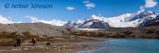
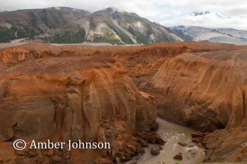
Nick, Sarah, and Kasey hiking next to the River Lethe._MG_8820Footprints in the pumice._MG_8849

Looking back down valley. The hiking was incredibly easy, with spectacular views in every direction._MG_8895
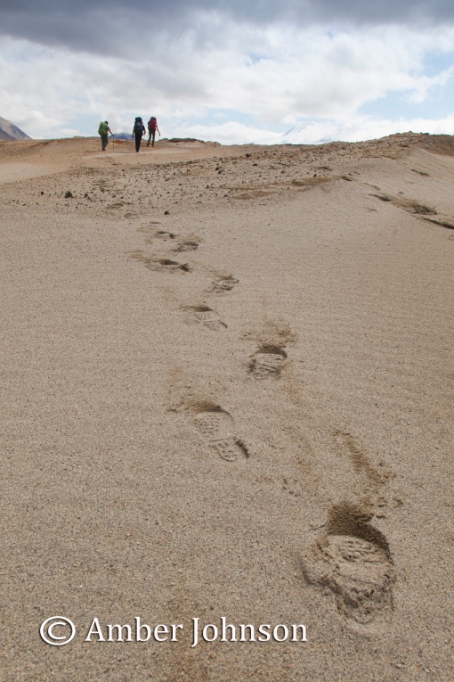
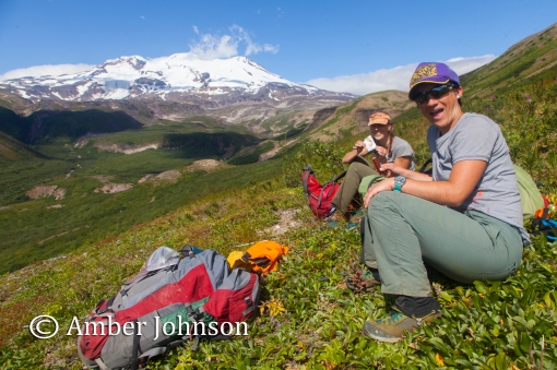
My partners in crime-Nick, Kasey, & Sarah._MG_8919Mount Mageik. There are crazy colors in the Valley of 10,000 smokes. Almost looks like a box of colored chalk exploded everywhere._MG_8932Novarupta!_MG_8952
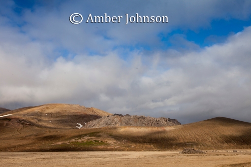
More amazing colors at Novarupta. We found ice melt for water & a small stream. Novarupta still lets off steam and at the vents felt like a steam bath at the spa._MG_8967

_MG_8987Awesome colors everywhere._MG_9097Day 3, we hiked up Broken Mountain & looped around Novarupta. We had hoped to also hike up Fallen, but the weather moved in & soon it was blowing 30 mph.

View of Baked Mountain, taken from Broken Mountain._MG_9101
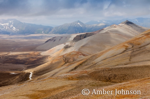
Kasey coming around the backside of Novarupta, with Mt. Katmai in the background._MG_9110Novarupta in the foreground with Baked Mountain in the background._MG_9165Little vegetation (and less water) in the Valley of 10,000 smokes. We did find some water areas that others didn’t. Dwarf fireweed, Baked Mountain._MG_9193The winds picked up early on night 3, 30-40 mph. Luckily, we had a 3 person, 4 season Hilleberg. We camped in a pretty protected area (as protected as it gets in the Valley), we still had to tighten guy lines a couple times through the night. We woke up the morning of Day 4 with high winds and little visibility. We checked weather, and was told it was going to stay like that for two more days, then break. We decided to make a go for Katmai Pass and head out of the Valley.

Photo by Kasey Keogh. Me & Sarah. This is not Katmai Pass.IMG_1370

Admission: We used a map to navigate with very limited visibility (high winds and fog) trying to save batteries on our DeLorme (we were saving what was left of batteries for communication with pilot). Anyone familiar with my navigation skills wouldn’t be surprised we went in big circle……..Day 4 ended up being the day we took our packs for a walk…….

That afternoon the rain came with the wind. Sheets of rain and 30-40 mph winds. More tent time……At least we stayed dry in the Hilleberg. Around 2:30 am we heard a large animal outside our tent, we didn’t invistigate-just made a lot of noise……It was hard to tell the next morning with how saturated the ground was, but believe it was a bear.

Day 5. Still raining sideways. Promise of good weather to come tomorrow. We pack up and head to Katmai Pass, this time using the GPS 🙂 The rain quickly soaked through our Gore-tex, we kept a good pace, eating while walking to keep warm. We wished we had visibility to enjoy the last of the Valley, but that was not to be. We crossed the swollen rivers and creeks. Finally making it down to the other side, we set up camp early, stripping off our drenched clothes and warming up with hot tea and sleeping bags. More tent time……

Day 6. Holy Smokes! Sunshine, blue skies, and over 70f. Visibility! Day 6 is off to a good start! We weren’t too sure which way to head around Observation Mountain. We chose the wrong way. Hours of bushwhacking through thick alders in bear country, making little progress was deflating. We finally got to a place where we could head straight up the mountain and rise above treeline. Crazy going from the Valley of 10,000 Smokes where water & vegetation were scarce to overflowing rivers and dense alders in just a few miles.

Sarah & Kasey fueling up on meat sticks after the schwack._MG_9232
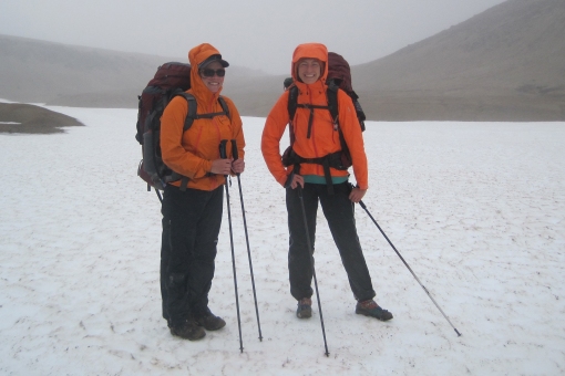
Coming down Observation. Beautiful view of Katmai River valley & the coast!_MG_9267Really cool rock formations on Observation._MG_9273A look back at Observation & waterfall._MG_9279_MG_9299White sand (actually it’s pumice). It felt like a day at the beach! Certainly was hot enough for it 🙂_MG_9305We had what felt like hundreds of river crossings to get to our destination. Kasey & Sarah crossing one of many braids on the Katmai River. Unfortunately, we didn’t make it all the way to the coast-the rivers were too high from unseasonably late snow melt (the Alaska Peninsula had a huge snow year….crazy, the rest of Alaska didn’t see much of the white stuff). Luckily, our pilot was able to give us an alternate destination he could pick us up at._MG_9381Deckload Aviation. Keller. Best Air Taxi EVER.
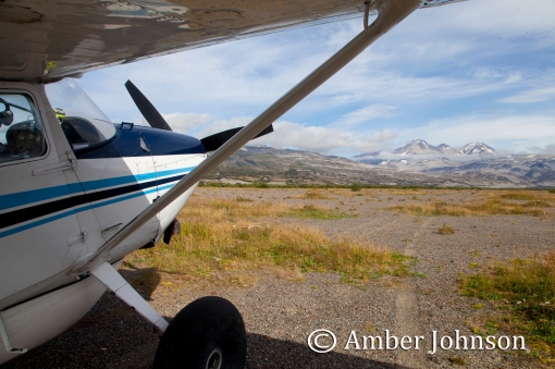
_MG_9397


Donoho Lakes Loop

31 05 2016

Perfect weather + 3 day weekend + Alaska = Pure awesomeness.

I hadn’t been to Kennicott/McCarthy in years, so when Becca suggested the Donoho Lakes trip I jumped at the idea. Evan, Becca, Shiloh (pup), and I did the 18 mile loop overnight and enjoyed some spectacular scenery along the way. Starting at the Kennicott mine we hiked the 2 miles to the Root Glacier. There we strapped on crampons and began our trek across the Root Glacier.

_MG_2986

_MG_2992

_MG_3023

Looking up the Root, with the medial moraine on the left.

_MG_3012

Crossing the next section of the Root. We found the Root relatively easy to cross, but there are definitely some sections that would be trickier. It took us about an hour to navigate our way to the other side.

Becca

_MG_3031

First Donoho Lake, with Donoho peak on the right.

_MG_3049

The scenery was terrible 🙂 Evan & Becca hiking towards the second lake.

_MG_3054

The Mid with Donoho Peak. Donoho Peak is approximately 3500 ft. above camp.

_MG_3081

Evan, Becca, Shiloh trekking past small glacial lake on the approach to the Kennicott Glacier.

_MG_3127

Moraine of Kennicott.

_MG_3135On the Kennicott!_MG_3157

_MG_3166

_MG_3186

The crew passing one of many spectacular turquoise glacial lakes.

_MG_3213

Storming in the distance. Crazy storm moving our direction.

_MG_3294

The storm quickly approaching on the Kennicott.

_MG_3332

After leaving the Kennicott Glacier we crossed a huge moraine back to the Root. The storm barely hit us on the moraine with a few drops then retreated back down valley. We saw a crazy ice tunnel in the moraine you could drive a semi through, unfortunately my camera (for once) was safely tucked inside my pack 😦

Back to the Root. Perfect trip, perfect crew._MG_3353


The Annual October Canoe Trip

2 11 2015

With fresh snow on the ground and little time to pack, we still managed to pull off our annual October canoe trip. I met Adam & Melissa in Moose Pass on a sunny (yet chilly) Halloween day to explore new territory. We put in at Trail Lake paddling 1/2 mile or so to a trail that led us 1.7 miles to Grant Lake. Although, I’d never heard of Grant Lake before, Adam has been interested in getting in there and exploring it for awhile.

The put in on Trail Lake.

trail lake put in

Adam & Luke on Trail Lake.
adam and luke

Adam paddling

Once we got to Grant Lake, we paddled down the lake to check out an old mining camp. Here’s one of the buildings still left. The rest are in much worse condition.


mining building

Returning to camp on Grant Lake. Grant Lake is one of the most gorgeous lakes I’ve seen. I can’t wait to explore more of it on longer summer days…

Melissa paddling

It was a crystal clear, starry night. The Kifaru’s wood stove kept us toasty. Later, the moon was so bright I asked Adam if he left his headlamp on inside the tent. He told me it was the moon & I stuck my head outside to see one of the brightest moons I’ve ever seen.

starry Kifaru

Sunrise, Grant Lake.

sunrise canoe grant lake


Elmo & Rachael do the Royal Basin

14 08 2015

 Andres was able to join Rachael and me for a quick overnighter to the Royal Basin. We did the 7 mile hike in, set up camp, then hiked a mile or so to the upper tarn to do some recon for future trips. The Olympics did not disappoint with more amazing views & stunning scenery.

This is what happens when you try and take a nice picture of your friends…..

A & R Royal Basin

 Rachael hiking towards the upper tarn.

Rachael Royal Basin

Rae Royal Basin


Upper Tarn.

upper tarn

Andres hiking above upper tarn

mtns

Andres testing his rock climbing skills on chunky choss.

rock climbing

Andres above upper tarn

Deer were pretty abundant in the area. Mom with twins.

deer & twins


The High Divide with Rachael

13 08 2015

The High Divide is a gorgeous 18 mile loop in the Olympic National Park that starts (and ends) in a lush rainforest full of gigantic trees that seem large enough to build a tiny house in, then rises to high alpine tundra with spectacular views of the Seven Lakes Basin & Mt. Olympus. Although the loop can easily be hiked in a day, spending a few days backpacking there exploring the lakes & soaking in the amazing views is definitely the way to do it. I haven’t spent anytime backpacking in the Lower 48, so when Rachael invited me on this trip I jumped at the chance to see her & check out some new territory. With temperatures in the mid 80’s it was slightly warm for this Alaskan girl, but I managed 🙂

 Sol Duc Falls.

sol duc falls

 Our first camp was Deer Lake. Sunset, ginormous trees, & of course, the Mid.

sunset mid deer lake

Another beautiful, sunny morning in the Olympics.

trees deer lake

Rae high divide1

We decided to take a long lunch break, siesta, & swim at the Seven Lakes Basin. The Basin is the premiere camping spot on the High Divide Loop, but fills up quickly. We planned this trip months ago & weren’t able to secure a site there. The lakes are pretty cold (as you would suspect any high alpine lake to be), but a perfect way to cool off from the heat 🙂

Rachael descending into the Seven Lakes Basin.

Rae above 7 lakes basin

View of Round Lake.

7 lakes basin view

Rachael soaking in another amazing view of the Basin.

R lunch lake

Wildlife was abundant! I felt like I was in the Disneyland of animals & gorgeous views! We saw black bears, mountain goats, & tons of deer.

deer hd

R HD

Rachael high divide

We took the very short side trip & climbed Mt. Bogachiel. Well worth the 360 degree spectacular views!

Descending back down to the trail we found these guys…..

mountain goats

mountain goat

Rachael looking back to the Seven Lakes Basin.

Rachael 7 lakes basin

Rachael fulfilling her promise to pump water for me at Sol Duc Park 🙂

pumping water Sol Duc Park

Rachael & me.

R & me HD

We finished the loop & headed over to Olympic Hot Springs for one last perfect night out, ending our amazing trip with a soak in the hot springs.

Morning sun shining through the trees at Olympic Hot Springs!

trees olympic hot springs


East Fork Chulitna-Mistakes Made & Lessons Learned

18 06 2015

I’m not sure why, but every time we start these trips, we try and avoid getting our feet wet at all costs, knowing full well it’s just a matter of time (and usually sooner than later) that our feet will be soaked. In the first 1/4 mile we ran into a large puddle/pond in the four wheel trail and bushwhacked around it. This was the first (and really only) bushwhack of the first day….Less than 20 minutes later our feet were soaked for the duration of the trip.

After going through bushwhack hell on the last trip using the Hardage Creek Route, we decided to take the northern route this time-we’ve seen great reports of little bushwhacking and decided to give it a try.

Beautiful views of Denali and the Alaska Range. Another amazing, sunny, warm weekend in Alaska.denali view beginning

After we left the easiness of the four-wheeler trails, we found some great high alpine game trails.

Boone hiking up towards the pass.

boone hiking

Jeff & Sarah climbing towards the pass.

sarah & jeff hiking

After reaching the pass, we looked at the map. Previous packrafters had taken the ridge left (headed slightly farther upriver), descended towards the creek, then made another pass before getting to the East Fork Chulitna near Crooked Creek. The East Fork Chulitna seemed so close! We decided to roll the dice & try our own route, knowing quite well the odds were greatly against us. Crazy thing is we succeeded 🙂 By doing this, we probably cut 3 miles off the hiking portion of the trip and only sacrificed about 1/2 mile of floating. We decided to stay high, traversing the ridge right.

Boone & Kasey.

 kasey and boone hiking

We started descending the nose & found a good place to take a break and fuel up before what we thought potentially could be a long bushwhack to the river. Here’s the view looking up river to Crooked Creek area. Once we descended to the valley floor, we wound up hiking in the general direction of up river, ending about 1/2 mile below the confluence of Crooked Creek.

checking maps

View down river & faintly the Alaska Range.

 group view of valley

We managed to find a route down, all tundra hiking. From the top we scouted several treeless areas & headed towards the first one. We easily linked up open areas with animal trails through the trees. It was definitely not a bushwhack. We even found a large downed tree to cross the creek on.

Sarah heading down the nose.

   sarah hiking down

Camp! I love Alaskan summers! I took this at 10:30 pm.

camp

Our put-in to the East Fork Chulitna.

yak

The first few miles of the paddle went smoothly. Fun, Class 2. Splashy. I’ve done this paddle before and loved it. The two canyons were challenging and the rest was pure easy fun. I led the paddle into the first canyon-a Class 3/3+ canyon. After making the first few rapids, I made a costly mistake-I got to close to a boulder, got high sided, from which I couldn’t recover and went for the swim of my life. I’m not sure if it was complacency  or just the littlest/giant mistake. Going into that rapid, I thought I had it. There wasn’t even a question in my mind. Now, instantly, I knew I was in pretty big trouble. There are few small eddies in the canyon, mostly rock walls, and I had 3 big drops to go & probably 125 yards till the river calmed back down to a fast Class 2.

I managed to hang on to my raft and my paddle, trying desperately to right my raft & when eddies appeared swimming desperately for them. I was almost able to catch one or two before the current grabbed me & threw me into another rapid. I was being thrown into boulders & over drops, getting pushed underwater, then being able to come up for air in time for the next one. My crew was desperately trying to catch me & help, doing everything possible. At one point, Kasey got to me, but I was unable to get close enough to her to grab her boat before we got separated in a rapid. Finally, my boat got caught on a large boulder (upside down) in an impossible place in the river. Boone caught up with me at some point & I was able to grab onto him for a second before we came upon the next rapid and had to let go. I was absolutely exhausted and knew I had to keep fighting. I kept swimming with my paddle, the river tossing me around like Raggedy Ann, with my head headed straight into a boulder. I narrowly missed bashing in my skull (how I don’t know, I was suprised-Boone saw it and was trying to figure out how he was going to get me unconscious or dead out of the river.) Regretfully, I had left my helmet at home. Definitely, won’t be doing that on future trips. Finally, I dumped out of the canyon into Class 2. The river isn’t terribly deep here-knee to mid thigh-just super fast. Boone managed to get to me, with Jeff right behind him. I grabbed onto the rope on the rear of his boat and he managed (I don’t know how) to get us to shore-NOT in an eddy (He said it was like dragging 3 boats). He jumped out of his boat, grabbed me with one hand & his boat with the other hand. I was so exhausted I couldn’t walk. I laid on shore breathing hard & exhausted-happy to be alive.

My hands were frozen-screaming barfie style, but the rest of me was relatively warm & dry. I felt like I had been through Fight Club-exhausted, my legs were so beat up-deeply bruised muscles, with visible ones on the surface (some bigger than my hand), as well as some good gashes. But I was ok. I did get a hole in my brand new Stowaway Tough drysuit by Alpacka-although, I truly believe this would have happened in my regular Kokatat drysuit as well. My long underwear was also ripped and I had a gash in my knee where the drysuit was ripped. I stayed pretty dry despite the hole. In the end, my pack broke the Packtach rope in half from the water pressure & floated downstream. Boone was able to jump in his boat & grab it. The pack coming off knocked the boat off the boulder into an eddy. Kasey & Sarah had managed to eddy out and grab it. Also, it happened to be one of the fewer parts of the canyon they could hike out of-so they packed up everything & hiked out to us.  I was so happy to see them.

Since I was to exhausted to boat the second canyon, (and the big class 3/4) rap, we had to hike around it (maybe 1 or 1 1/2 miles). I mean bushwhack. It was the hardest hike ever due to my legs being completely sore & beat up. My muscles barely wanted to put one foot in front of the other, much less with a pack & climbing over hills.  Thankfully, my crew grabbed my boat, paddle & pfd to take some weight off my back. Sometime after the big rapid, we managed to hike down to the river & paddle the rest of the trip. The rest of the float is a fun, splashy Class 2 all the way back to the highway. Although, I tried to enjoy the rest of the paddle, and definitely had some good moments, it just wasn’t the same for me. We got back to the car a few hours later than we expected due to the swim, and ended up getting “stuck” in Talkeetna, due to the Sockeye fire in Willow. It was 80F and a good place to chill out, relax, & reflect over a few beers on the banks of the Talkeetna River with the sun setting over Denali.
sunset denali talkeetna